

Located in Pickering, Dixie Cliffs offer gorgeous scenic views of the Seaton Hiking Trail and Duffin’s Creek. It’s an unofficial name for a cliff located near the corner of Concession Road 3 and Dixie Road.
It is one of the locations I have spent so much time during my youth. It is a great place to meet up with friends, set up folding chairs, and spend hours chatting while enjoying the view.
How to get there
You can get to Dixie Cliffs through an entrance located near Dixie Road and Concession 5 in Pickering, ON. There is free parking at the side of the road. Cross the railroad south at the road crosswalk, and head east to the entrance to the cliffs (marked in image below).


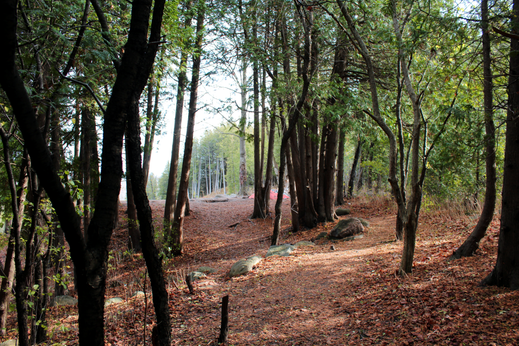
The trail from the road is short (about 100m), and takes about 1-2 minutes to reach Dixie Cliffs. The path is well-defined and easy to follow. Be prepared in wetter weather, as this path can get pretty muddy.

After travelling through the pathway, you will reach Dixie Cliffs and be presented with the breathtaking view!
What does Dixie Cliffs overlook?
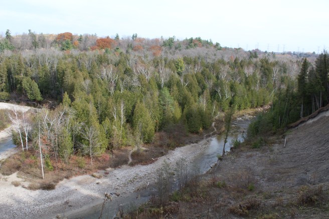
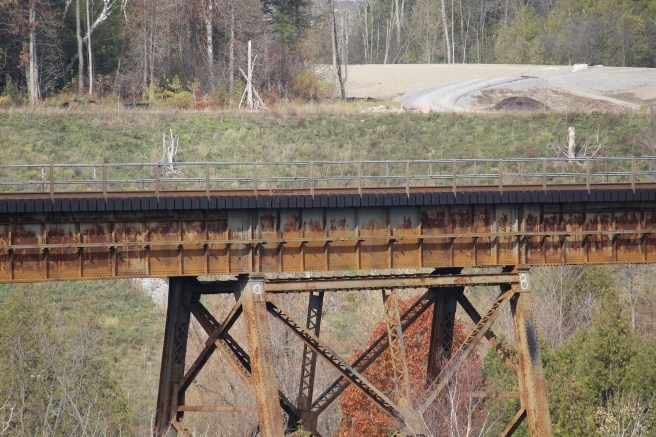
The view is absolutely spectacular, overseeing the Seaton Hiking Trail, and Duffin’s Creek. You also get a solid side view of the railway bridge over the valley.

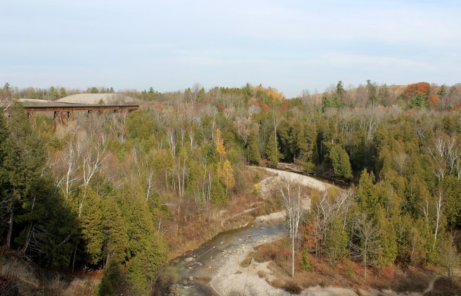


Turns out, the hill the furthest from your viewpoint is Brock West landfill. I learned this originally because 2 of my best friends at the time, after years of looking at this mysterious hill with seemingly a way better view, decided to find out for themselves what it was. They packed up and spent a day hiking down the side of the bluffs to the other side of the valley. Not sure why this was not Google’d previously, as it would save them the disappointment of finding out they couldn’t even climb the hill!

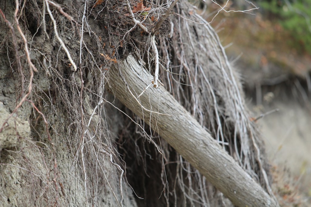
I can remember years ago the bluffs being further out, and the pathway by the cliffs less narrow. Because of erosion over time, some of these areas have completely fallen away. I remember visiting the cliffs and seeing parts of trees and vegetation begin to loose grip and lean more askew. When visiting the following day, I’d find these pieces have completely fallen.
I hope it goes without saying to be safe and aware when anywhere near the cliff. Seriously. Most of the ground closest to the edge is unstable, so keep a safe viewing distance. It’s also good to note to not venture anywhere near the railroad.
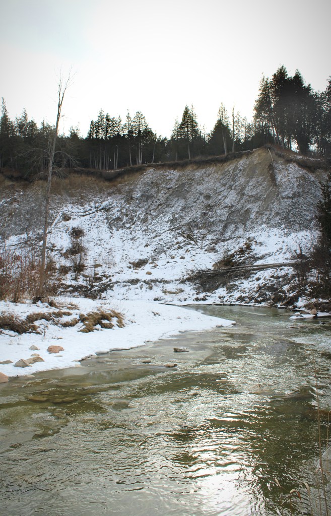
View of the cliff from below (Jan ’21).
Let us know in the comments if you have visited Dixie Cliffs, and what your experience was!
Safe trekking!

Agawa Rock Pictographs at Lake Superior Provincial Park
Nature has a remarkable way of preserving history, and nowhere is this more evident than at the Agawa Pictographs in Lake Superior Provincial Park. Tucked away along the rugged shores of Lake Superior, these rock paintings offer a glimpse into the life of the Ojibwe. With red ochre (using a mix of iron oxide to produce…

Serpent River Park in Algoma
Serpent River Park is a captivating place to stop for a rest if you are exploring the Algoma region, and travelling between Sault Saint Marie and Sudbury in Ontario. Located roughly between the halfway point of these two cities, you can access the park on the south side of the Trans Canada Highway (Google Maps…

Scout Valley in Orillia
It’s official – we’ve moved to Orillia! We weren’t loving the city life, and wanted to move somewhere closer to nature and outdoor activities. The traffic, commuting times, and lack of green space was getting to be exhausting. Aside from a few hiking spots within Mississauga, we found we had to drive outside of city…

Snowshoeing at Arrowhead Provincial Park
Arrowhead Provincial Park is owned and managed by Ontario Parks and is located just north of Huntsville, Ontario. Arrowhead is a beautiful and diverse park that offers a range of recreational activities for visitors both in the warmer and colder season, with activity equipment rentals available year-round. Arrowhead is a popular winter destination, with several…

3 comments
Should check this out next time I am in the area! ❤ Looks beautiful.
LikeLiked by 1 person
My late husband Lewis Lees played here and on the tracks when he was a boy.He lived close by.He passed away 5 years ago at 70yrs old ,so it was awhile since he played there.
LikeLiked by 1 person
Thank you for reading and your comment, Fran.
LikeLike