

Forks of the Credit Provincial Park is located within Caledon, and its 282 hectares is managed by Ontario Parks. It’s about an hour drive northeast from Toronto and features approximately 10 km of hiking trails including the Bruce Trail. We visited on a Saturday in September and made sure to reserve in advance online for a Daily Vehicle Permit. You can reserve in 4 hour time slots or full day permits (we reserved for 12 PM – 4 PM). The parking lot was completely full when we arrived and left, and it’s one of the busier trails we have visited, as we often came across groups of people.

Starting off on Meadow trail from the parking lot. 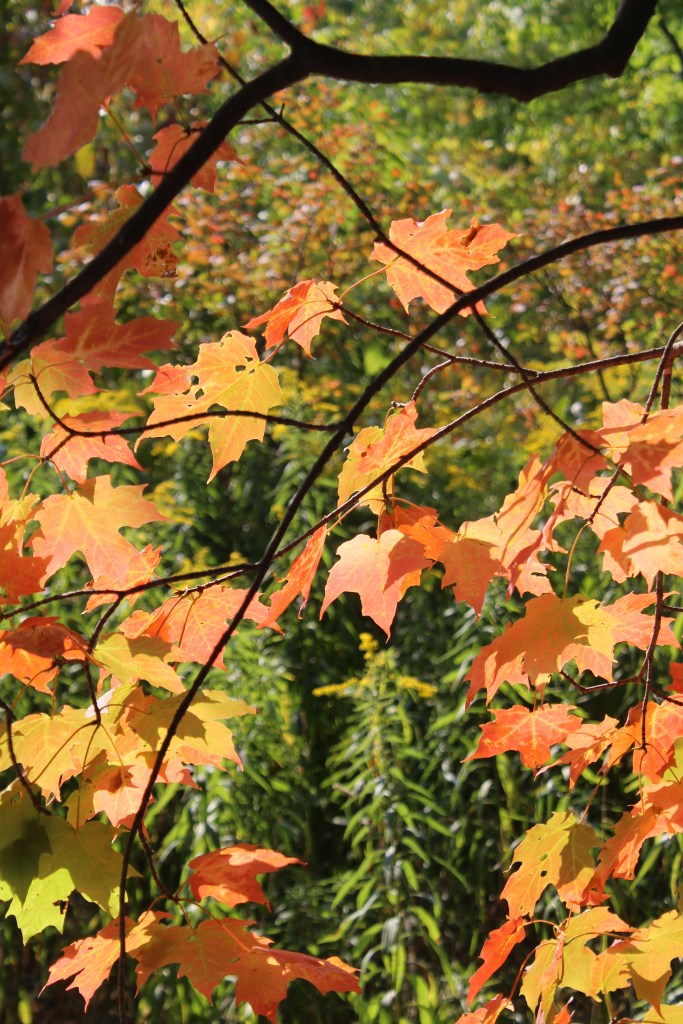
Maple leaves changing colours in early fall.
We started our hike at the park entrance off McLaren Road, and hiked along the Meadow Trail to the viewpoint of the falls and back (about 5-6 km in total). This hike is moderate difficulty, and was pretty tiring where we had to take a few breaks. This trail guides you through terrain of varied elevation up and down moraine hills and the escarpment edge. There’s also a nice diversity in the flora – our hike started with views of rolling meadows and hills of the moraine and closer to the waterfall was a hike through a cedar forest.
Forks of the Credit is a special place that highlights the features of geological forces over time. The Niagara Escarpment which encloses the valley is the remaining hard limestone and other rock initially deposited from an ancient body of water that covered the area that is now the Great Lakes over 400+ million years ago. Differential erosion and glacial movement that receded around 10,000 years ago formed moraines and kettle lakes that can be seen at this provincial park. This also eroded away softer rock, leaving the hard limestone that forms the Niagara Escarpment remaining. Credit River that flows from Orangeville cuts through the valley on its journey to Lake Ontario.

Foliage of a maple tree changing colours – autumn is here! 
Kettle Lake at the beginning of Meadow Trail. Kettle lakes are geological features leftover from retreating glaciers over 10,000 years ago. 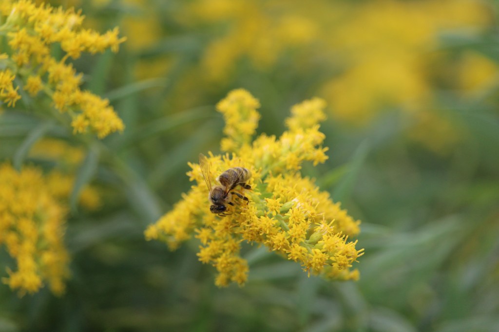
Bzz bzz. 
Vivid wildflowers. 
Cool looking dead tree on Meadow trail. 
The contrast of colours in September was so pretty! 
The redness of sumac trees meeting an open meadow.
The park’s history begins with being an important spot for indigenous peoples for gathering and fishing. In the industrial era, the region became an important spot for production and natural resources including the creation of mills, quarries, and powerhouses. Up until the 1930’s, a railroad station was operating with the purpose of bringing sandstone and other supplies to market. Some of Toronto’s most historical buildings including the parliamentary buildings of Queen’s Park was built using resources from quarries at Forks of the Credit.

Bark of a cedar tree. 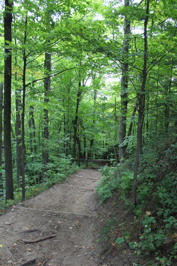
The hike down into the valley on Meadow trail. 
Fungus thriving on a dead tree.
The actual view of the falls when reaching the end of the Meadow trail was not spectacular as foliage and trees obstructed most of the view. The trail seemed to cut off abruptly before you can venture closer to the falls, but this seems purposeful for safety reasons as the soft rock did not seem to be too stable past the trail end. Some people hopped the fence to try and get a closer look but we didn’t risk it.

Hike to the end of Meadow trail. This area of the trail was pretty busy on a Saturday around 3 PM. 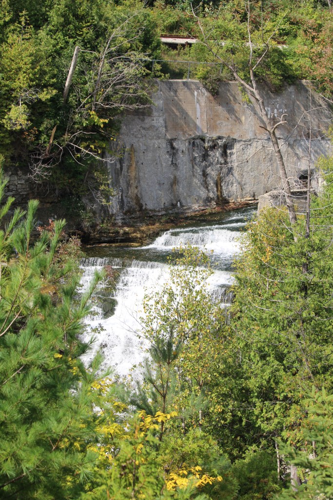
View of the falls using a zoom lens. To the left is a glimpse of the layers of ancient rock that makes up the escarpment.
We look forward to revisiting to explore some of the other trails.
Have you visited Forks of the Credit Provincial Park? Let us know about your experience in the comments below!

Agawa Rock Pictographs at Lake Superior Provincial Park
Nature has a remarkable way of preserving history, and nowhere is this more evident than at the Agawa Pictographs in Lake Superior Provincial Park. Tucked away along the rugged shores of Lake Superior, these rock paintings offer a glimpse into the life of the Ojibwe. With red ochre (using a mix of iron oxide to produce…

Serpent River Park in Algoma
Serpent River Park is a captivating place to stop for a rest if you are exploring the Algoma region, and travelling between Sault Saint Marie and Sudbury in Ontario. Located roughly between the halfway point of these two cities, you can access the park on the south side of the Trans Canada Highway (Google Maps…

Scout Valley in Orillia
It’s official – we’ve moved to Orillia! We weren’t loving the city life, and wanted to move somewhere closer to nature and outdoor activities. The traffic, commuting times, and lack of green space was getting to be exhausting. Aside from a few hiking spots within Mississauga, we found we had to drive outside of city…

Snowshoeing at Arrowhead Provincial Park
Arrowhead Provincial Park is owned and managed by Ontario Parks and is located just north of Huntsville, Ontario. Arrowhead is a beautiful and diverse park that offers a range of recreational activities for visitors both in the warmer and colder season, with activity equipment rentals available year-round. Arrowhead is a popular winter destination, with several…

Claireville Conservation Area
The busy holiday season is done and over, and finally we have had the opportunity to slide back into our regular routine, and spend some time hiking and exploring. We had visited Claireville Conservation Area in October to see the leaves change colour, and being so close of a drive, visited again in January of…

Spruce Bog Boardwalk at Algonquin Provincial Park
Spruce Bog Boardwalk is a quick and easy hike along the Highway 60 corridor in Algonquin Provincial Park. The trail is 1.5 km and made up mostly of boardwalk, and is a leaisurley path with even terrain. We visited the trail on a Saturday in Late October in the early afternoon, and the parking lot…

It’s crazy how busy the Forks of the Credit has become over the last few years. We used to come hiking here all the time and never had any issues with parking or the crowds. It’s great that they’ve implemented the reservation system though.
LikeLike
Thanks for your comment. It was my first time ever visiting and it was absolutely packed! We had a few strangers we could chuckle with as we all struggled up the hill back to the parking lot. But definitely a good thing the reservation system is in place I agree.
LikeLiked by 1 person
We used to do a 16km loop hike through there to Belfontaine and back up Mississauga Road. I now see they have closed another road in the area, making for an even longer hike. So have not returned. Rather hike Island Lake, or Hockley Or Mono
LikeLike
Thanks for commenting!
LikeLike